No Image Lotto 43A 3 Maps to include Denmark and Spain, all framed and glazed (one has broken glass) 48cm x 59cm approx 43A3 Maps to include Denmark and Spain, all framed and glazed (one has broken glass) 48cm x 59cm approx Barry L Hawkins 3 Maps to include Denmark and Spain, all framed and glazed (one has broken glass) 48cm x 59cm approx Add to watchlist Vivere
No Image Lotto 44 5 prints inc map of Essex 445 prints inc map of Essex Barry L Hawkins 5 prints inc map of Essex Add to watchlist Vivere
No Image Lotto 63 Qty 1880's maps of area's to South End of Wisbech showing land division and 2 antique Atlas' 1906 63Qty 1880's maps of area's to South End of Wisbech showing land division and 2 antique Atlas' 1906 Barry L Hawkins Qty 1880's maps of area's to South End of Wisbech showing land division and 2 antique Atlas' 1906 and 1922 Add to watchlist Vivere
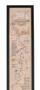
No Image Lotto 93 THE OARSMANS AND ANGLERS MAP OF THE THAMES 93THE OARSMANS AND ANGLERS MAP OF THE THAMES Dreweatts 1759 THE OARSMANS AND ANGLERS MAP OF THE THAMES Mounted, framed and glazed 175 x 14cm overall Add to watchlist Vivere
No Image Lotto 107 Two framed antique maps of the Channel Islands 107Two framed antique maps of the Channel Islands The Pedestal Two framed antique maps of the Channel Islands One in monochrome by John Speed, 39cm x 52cm, the other hand coloured, 40cm x 48cm. (2) Add to watchlist Vivere
No Image Lotto 1348 A box containing two sets of jump leads, rope, flu 1348A box containing two sets of jump leads, rope, flu Clarke and Simpson Auctions A box containing two sets of jump leads, rope, fluorescent jacket, map of Suffolk, Thule kit 5099 brackets in original box etc. Add to watchlist Vivere